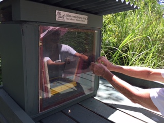
Red Road Press established a Little Free Library (LFL) in July, 2017 on our rural property adjacent to Noni Farm Road at Kapoho Road in Pahoa, Hawai’i. There is a public library in the town of Pahoa but that is quite a distance to walk or cycle, the usual transportation for many residents of beautiful agricultural South Puna district where public transportation is scarce.
 The LFL was an instant attraction for the many families who lived along the cinder road. Young residents who stopped to browse and select a book. Donated books came from neighbors and retired teachers, as well as my own shelves. The LFL also served the many agricultural workers who travel the rural cinder and gravel lanes to the noni or papaya fields far from the highway.
The Island of Hawai’i has experienced many lava eruptions. South Puna is in the East Rift Zone of Kilauea Volcano. In the immediate area, there were flows in 1955 and 1960. Kalapana, a long established town on the South shore, was obliterated during several catastrophic lava flows in the 1980s and 90s. A thin, slow moving lava flow nearly reached the west side of Pahoa village during 2014.
Subsequent Kilauea lava streams violently arched into the ocean from the cliffs south of Volcanoes National Park, earning the headline “Fire Hose Lava”
Then in May, 2018 there were two violent earthquakes and thousands of small quakes concentrated in the Leilani Estates area south of Pahoa. Lava fissures or volcanic vents threatened the security of thousands of residents. One week the lava was concentrated in a southward direction; the next week, the lava force opened many new fissures spaced far apart. In all, 24 fissures opened in the Leilani Estates neighborhood to issue steam, sulphuric gasses and lava from Kilauea Volcano to the surface. 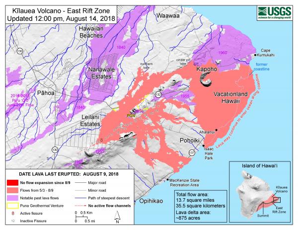
Fissure 8 steadily grew a massive cone of lava sending rivers of fast moving lava on the fastest path to the ocean. Fissure 22 burst open, sending several fingers of lava across pastures, crop fields, forests and parts of Route 132. Lava consumed Kapoho and Vacationland, several public recreation areas, filling Green Mt. Lake and Kapoho Bay.
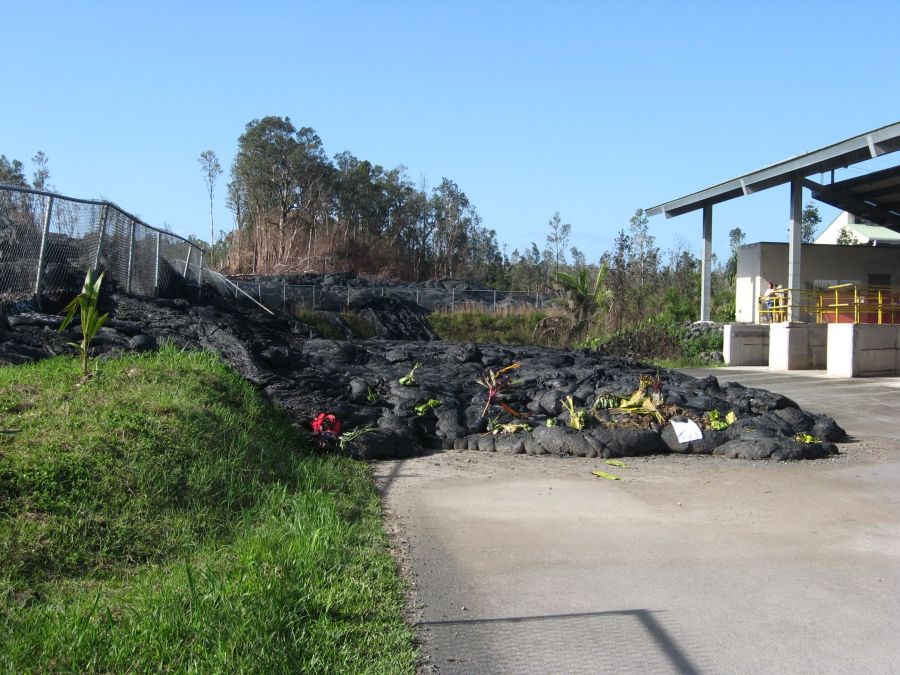
I evacuated during the last week of May. Friends phoned to warn that lava was headed down Noni Farm Road and tried to move my truck and other equipment to higher ground. Overnight lava covered the pastures and orchard, burning the barn, stables and all other outbuildings, including the Little Free Library which stood on the edge of out property facing Noni Farm Road.
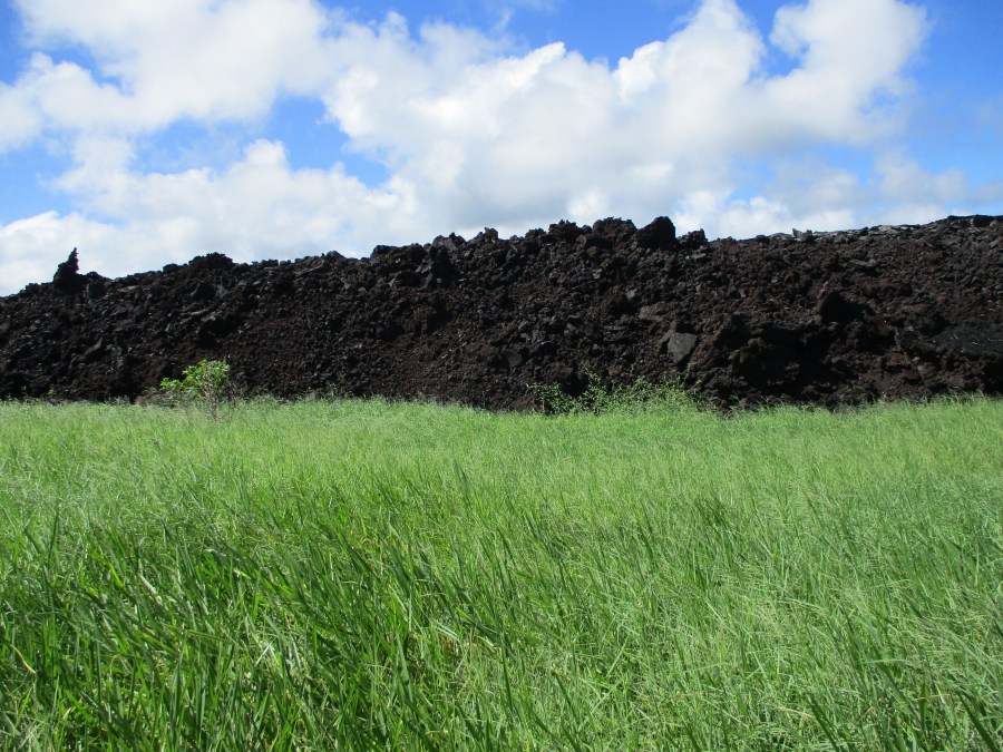
You can see on the lava flow maps for the Kilauea lava disaster that the LFL is covered. Perhaps someday, the local government will repair and replace the public roads and provide access to area residents whose property and houses survived the lava inundation.
Then Red Road Press will set up a new Little Free Library for all of the survivors living in the area.
